DMR Right Whale Survey Update
- Guest Writer
- Jul 31, 2025
- 2 min read
By Sarah Leiter, DMR Division of Marine Mammal Research
The Maine DMR Division of Marine Mammal Research Survey Program is designed to increase our understanding of when and where North Atlantic right whales occur in the Gulf of Maine by conducting monthly visual surveys from vessels and planes. A better understanding of right whale distribution and habitat use will improve and refine assessments of entanglement risk. These surveys have been conducted monthly since July of 2024.

Image Info Here
During surveys, standardized observation effort is conducted along pre-determined track lines throughout the Gulf of Maine. Standardized survey effort during vessel surveys employs two trained marine mammal observers on either side of the top deck observation platform and a third observer recording data while the vessel travels along track lines at a speed of 10 knots.
Standardized survey effort during aerial surveys employs two observers positioned on either side of the aircraft while the plane travels along track lines at a ground speed of 100 knots and an altitude of 1000 feet. Total standardized survey effort in nautical miles from both survey platforms (vessel and aerial) is summarized in the table below by month.
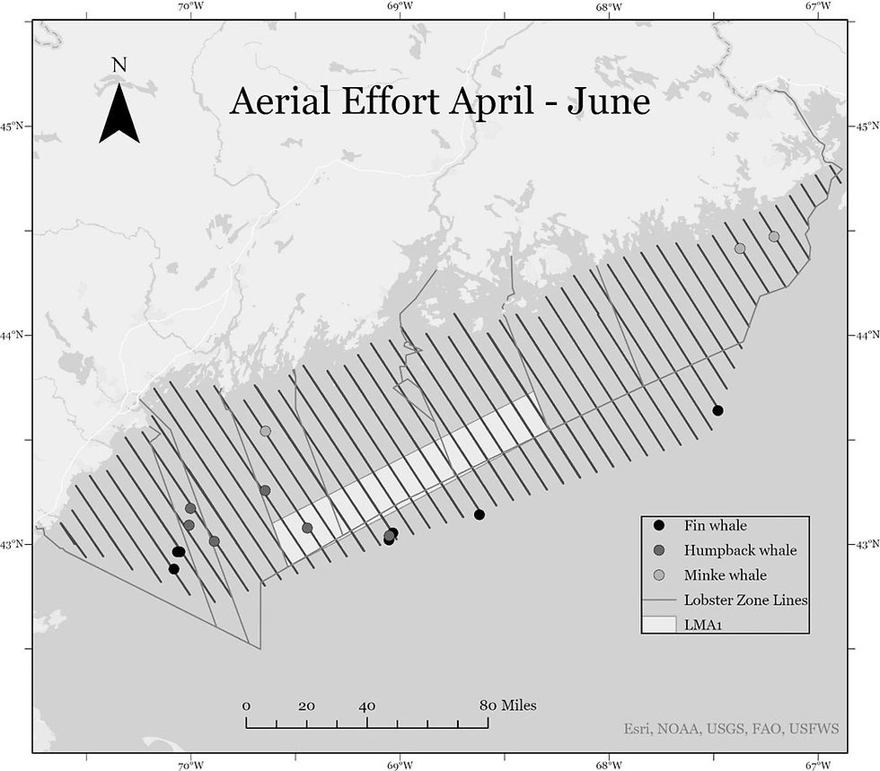
The results presented here are preliminary findings from aerial and vessel surveys for North Atlantic right whales and other marine species conducted April – June (2025). Only large and medium whale sightings are reported, including North Atlantic right, blue, fin, sei, humpback, sperm, and minke whales. The table below provides sighting totals by species for each month.
Survey effort and sighting locations are depicted by survey platform in the maps. Data is also collected for other marine species including dolphins, porpoises, sea turtles, seals, and large fishes.
More information on the DMR survey program, including monthly and annual reports, can be found on their website: https://www.maine.gov/dmr/science/right-whale/monitoring. Sightings of North Atlantic right whales and effort track lines from the Survey Program are posted on the day following each aerial or vessel survey to www.whalemap.org.
These data collected by the ME DMR Survey Program were collected under US NMFS Permit No. 27066 and US NMFS Permit No. 27858. The Survey Program enthusiastically accepts feedback and/or questions from the fishing community.
Please submit feedback/questions to Sarah.Leiter@Maine.gov.
To see a map of up-to-date whale sightings in the Gulf of Maine, visit www.whalemap.org.


Comments